Glassberg Family Conservation Area
Distance: 3 miles round trip
Location: south of Eureka, Missouri
Date: May 18, 2013
The Glassberg Conservation Area is in the LaBarque Creek watershed near the Young and LaBarque Creek conservation areas. It opened in December 2012 and encompasses 429 acres of Ozark foothills on the south side of the Meramec River.
Most of the trails in this area are former roads/driveways. Some sections of these roads are paved, others covered in gravel, and others are dirt. Hiking all of these trails is about 1.5 miles or 3 miles round trip. The trail around Buder Lake is the only loop while the others are out and back trails.
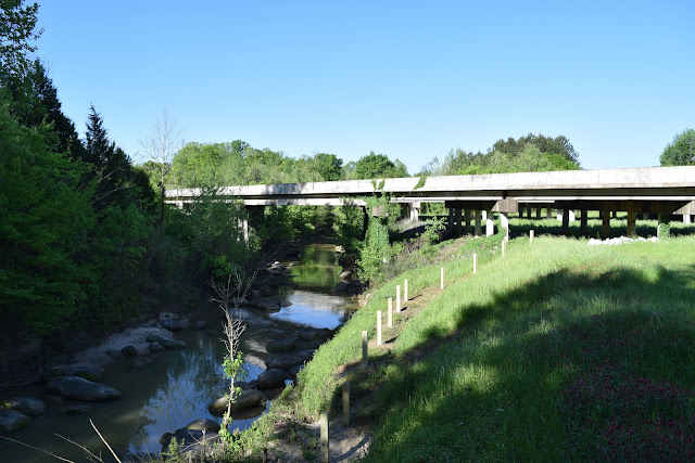
The primary trail goes from the trailhead up the hill and past Buder Lake. A side trail goes to a restored area that was probably a home site. The steepest portion of this trail is paved. Once past the home site, the trail becomes dirt and continues to a bluff rising above the Meramec River. It was very foggy the morning of my visit, so I could not see anything, but there are so many trees on the steep and rocky slopes that they would likely obscure the view anyway.
Buder Lake is a small lake with a trail going around its edges, and most of the people in the conservation area during my visit were fishing at the lake.
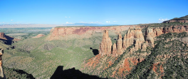
Near the trailhead a second trail diverges from the main trail and goes through fields and small sections of forest. This trail has very little elevation change except for along the start of the trail. Right when you turn onto this trail, you pass what I think is the most interesting rock formation in the area (although it isn't much - see below).
For detailed route information and a map see my track on AllTrails.
Location: south of Eureka, Missouri
Date: May 18, 2013
 |
| Buder Lake |
The Glassberg Conservation Area is in the LaBarque Creek watershed near the Young and LaBarque Creek conservation areas. It opened in December 2012 and encompasses 429 acres of Ozark foothills on the south side of the Meramec River.
 |
| The main trail |
Most of the trails in this area are former roads/driveways. Some sections of these roads are paved, others covered in gravel, and others are dirt. Hiking all of these trails is about 1.5 miles or 3 miles round trip. The trail around Buder Lake is the only loop while the others are out and back trails.
The primary trail goes from the trailhead up the hill and past Buder Lake. A side trail goes to a restored area that was probably a home site. The steepest portion of this trail is paved. Once past the home site, the trail becomes dirt and continues to a bluff rising above the Meramec River. It was very foggy the morning of my visit, so I could not see anything, but there are so many trees on the steep and rocky slopes that they would likely obscure the view anyway.
 |
| Looking down the hill towards the Meramec River |
Buder Lake is a small lake with a trail going around its edges, and most of the people in the conservation area during my visit were fishing at the lake.
 |
| Fields along the side trail |
Near the trailhead a second trail diverges from the main trail and goes through fields and small sections of forest. This trail has very little elevation change except for along the start of the trail. Right when you turn onto this trail, you pass what I think is the most interesting rock formation in the area (although it isn't much - see below).
 |
| Rocks near the intersection of the two trails |
For detailed route information and a map see my track on AllTrails.
© Copyright
2017 Matthew Pintar. All rights reserved.
Comments
Post a Comment