North Kaibab Trail to Ribbon Falls, Grand Canyon
Distance: ~6 miles one way
Elevation gain: 1300 feet
Location: Grand Canyon National Park, Arizona
Date: December 9, 2013
On day two of my backpacking trip in the Grand Canyon I started by hiking about six miles up the North Kaibab Trail to Ribbon Falls from the Bright Angel Campground near Phantom Ranch. The North Kaibab Trail traverses 14 miles from the North Rim to its intersection with the South Kaibab and River/Bright Angel trails near Phantom Ranch, and I had originally planned to stay two nights at Cottonwood Campground about 1.5 miles up the trail from Ribbon Falls.
After breakfast at Phantom Ranch, I began hiking up the North Kaibab Trail through the narrow canyon along Bright Angel Creek. The first four to five miles of the trail where completely shaded during my hike to the falls, but there were sections of sun during my return trip. Nearly the entire hike to Ribbon Falls is fairly flat, but with a gentle upward slope. However, just before reaching the trail to the falls, there is a steep section and then descent before reaching the bridge to cross Bright Angel Creek to the falls. You can actually walk through Bright Angel Creek below this steep section and avoid the climb, but the water was too high to make it across without getting wet when I was there, so I skipped it to avoid getting cold.
The side trail to the falls is very short, but involves a little bit of climbing around rocks, vegetation, and a small stream before actually reaching the falls. At the falls, an official trail goes up around the back side of the falls, but there are paths all around the area. There is an additional path that goes up above the falls to Upper Ribbon Falls and to some ruins, but this requires a bit more elevation gain and knowing where to find the hidden path. I spent about a half hour at the falls eating lunch and enjoying the sun that I missed throughout the cold of my morning hike.
By the time I began my return trip it was sunnier and felt a bit warmer, which made for a more pleasant hike and more interesting lighting along the lower part of the trail. Bridges cross Bright Angel Creek four times between Phantom Ranch and the trail to the falls, but I thought the most interesting point along this trail was the confluence of Bright Angel and Phantom creeks where you could see in three directions through these narrow canyons.
Just before reaching Phantom Ranch, I turned onto the Clear Creek Trail and followed for a few hundred feet before stopping at a point with a decent view for a break. I then returned to the campground where it reached a high of 39 degrees in mid-afternoon. Having over an hour to spare before my dinner reservations at Phantom Ranch, I hiked down to the Colorado River to do a loop hike along the River Trail.
For more about this trip see my posts on the South Kaibab Trail, River Trail, and Bright Angel Trail.
© Copyright 2017 Matthew Pintar. All rights reserved.
Elevation gain: 1300 feet
Location: Grand Canyon National Park, Arizona
Date: December 9, 2013
 |
| Ribbon Falls |
On day two of my backpacking trip in the Grand Canyon I started by hiking about six miles up the North Kaibab Trail to Ribbon Falls from the Bright Angel Campground near Phantom Ranch. The North Kaibab Trail traverses 14 miles from the North Rim to its intersection with the South Kaibab and River/Bright Angel trails near Phantom Ranch, and I had originally planned to stay two nights at Cottonwood Campground about 1.5 miles up the trail from Ribbon Falls.
After breakfast at Phantom Ranch, I began hiking up the North Kaibab Trail through the narrow canyon along Bright Angel Creek. The first four to five miles of the trail where completely shaded during my hike to the falls, but there were sections of sun during my return trip. Nearly the entire hike to Ribbon Falls is fairly flat, but with a gentle upward slope. However, just before reaching the trail to the falls, there is a steep section and then descent before reaching the bridge to cross Bright Angel Creek to the falls. You can actually walk through Bright Angel Creek below this steep section and avoid the climb, but the water was too high to make it across without getting wet when I was there, so I skipped it to avoid getting cold.
 |
| Morning along the North Kaibab Trail just above Phantom Ranch with the South Rim in the background |
 |
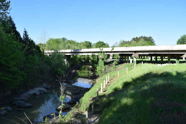
| One of the lower bridges on the North Kaibab Trail |
The side trail to the falls is very short, but involves a little bit of climbing around rocks, vegetation, and a small stream before actually reaching the falls. At the falls, an official trail goes up around the back side of the falls, but there are paths all around the area. There is an additional path that goes up above the falls to Upper Ribbon Falls and to some ruins, but this requires a bit more elevation gain and knowing where to find the hidden path. I spent about a half hour at the falls eating lunch and enjoying the sun that I missed throughout the cold of my morning hike.
 |
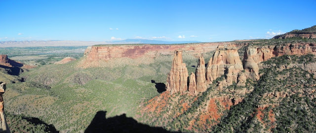
| Cliffs along the upper two miles of my hike |
 |
| About a mile or less below the falls |
By the time I began my return trip it was sunnier and felt a bit warmer, which made for a more pleasant hike and more interesting lighting along the lower part of the trail. Bridges cross Bright Angel Creek four times between Phantom Ranch and the trail to the falls, but I thought the most interesting point along this trail was the confluence of Bright Angel and Phantom creeks where you could see in three directions through these narrow canyons.
 |
| The falls are in the canyon right of center |
 |
| Cliffs along Bright Angel Creek |
Just before reaching Phantom Ranch, I turned onto the Clear Creek Trail and followed for a few hundred feet before stopping at a point with a decent view for a break. I then returned to the campground where it reached a high of 39 degrees in mid-afternoon. Having over an hour to spare before my dinner reservations at Phantom Ranch, I hiked down to the Colorado River to do a loop hike along the River Trail.
For more about this trip see my posts on the South Kaibab Trail, River Trail, and Bright Angel Trail.
 |
| North Kaibab Trail and Bright Angel Creek |
 |
| Along the North Kaibab Trail |
 |
| Looking up Phantom Creek |
 |
| Ribbon Falls |
© Copyright 2017 Matthew Pintar. All rights reserved.
Comments
Post a Comment