The Eagle Rock Loop is a 26.8-mile backpacking route through the Ouachita Mountains of western Arkansas (see the official U.S. Forest Service info here). This is perhaps the most popular backpacking route, and one of the best backpacking routes, in the region. That said, it is not usually crowded and you should have no trouble finding solitude on it.
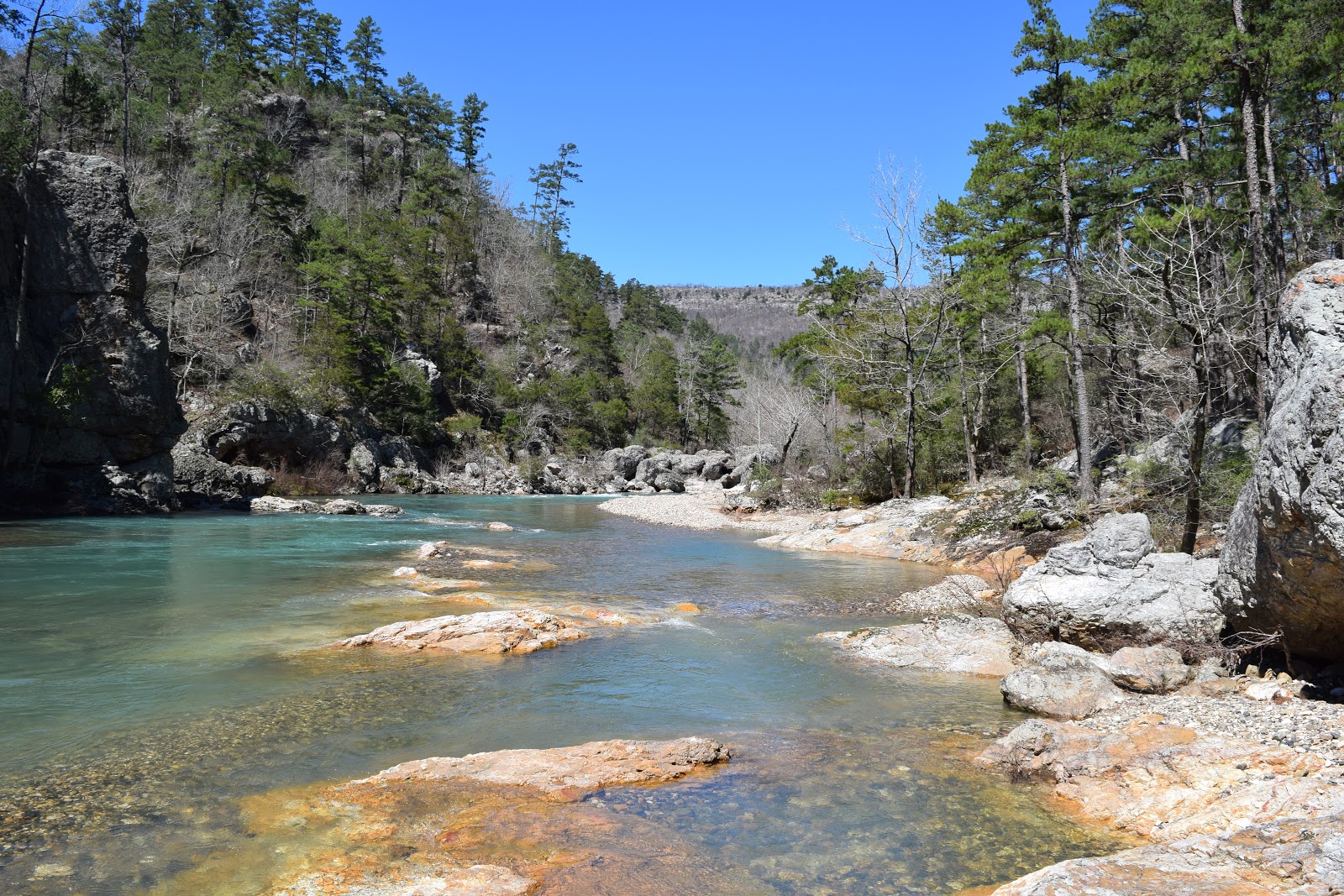
Little Missouri River at Winding Stairs. This is between the lower two river crossings.
Much of the route follows what were once postal wagon routes, with three primary sections: the Little Missouri Trail, the Athens-Big Fork Trail, and the Viles Branch Trail. Overall there is 4005 feet of elevation gain with seven mountain crossings, one on the Little Missouri Trail and the other six on the Athens-Big Fork Trail.
There are numerous water crossings, and depending on the season and weather, they vary in difficulty. The four major crossings of the Little Missouri River are of most concern. It is not recommended to attempt the major river crossings unless the USGS river gauge on the Little Missouri River downstream in Langley is below 4.0 feet (see this website). The morning I started hiking the gauge was a 5.5 feet, having rained the day before. There was no rain in the forecast for the next few days, so I started hiking at the Winding Stairs Trailhead and went counterclockwise, placing the two furthest downstream crossings in the last few miles of the hike. I would certainly recommend taking water shoes, especially when the water is high and cold. I know some people just do the crossings in their hiking shoes, but why get your feet soaked for days?
Little Missouri River along the trail on the first day
All of the major crossings were certainly passable for an experienced hiker, but the first one I encountered (third upstream) was certainly difficult due to high, swift water and large, slippery boulders. The next crossing wasn't as difficult, and there are not any additional water crossings until almost to the Athens-Big Fork Trail where there are two more crossings of the Little Missouri River, which at this point is not much more than a small stream.
View above the Albert Pike Recreation Area with the Little Missouri River below. This was the first mountain hiked on the first day.
I began hiking at the Winding Stairs Trailhead around 12:30 pm on a March afternoon and reached the junction of the Athens-Big Fork and Little Missouri trails around 5:30 that day. After about 12.5 miles of hiking the first day I camped along the stream for the night. The next morning I began hiking around 8:00 am. The trail immediately began climbing the first mountain of the day, reaching the pass below Hurricane Knob after around a half mile.
Little Missouri Falls, passed on the first day
I spent the rest of the morning hiking the Athens-Big Fork Trail, climbing up and down the six mountains. There were only two stream crossings that required getting my feet wet: Long Creek and Blaylock Creek. From the Blaylock Creek crossing it was 1.1 miles and over 700 feet of elevation gain up Brush Heap Mountain, which was the biggest and steepest climb on the trail (at least counterclockwise). None of the mountains are particularly difficult.
View from one of the mountains on the second day
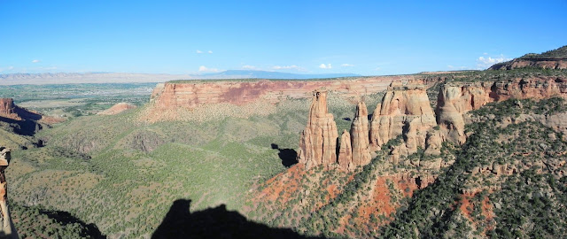
From Blaylock Mountain it was down the next valley, across Saline Creek, and up the final mountain to Eagle Rock Vista where I stopped for lunch. It is only about a half mile from Eagle Rock Vista to the Viles Branch Trail in the valley below. It is a relatively flat and easy 3.5 miles on the Viles Branch Trail to the Little Missouri River. There are numerous water crossings on the Viles Branch Trail, but I was able to do all but the furthest downstream (right before reaching the river) without getting my feet wet.
View from Eagle Rock Vista
Viles Branch and trail
On the Little Missouri River I found the furthest downstream crossing to be easier than the next upstream because the river there was wider and shallower, so I only got wet up to my knees. But on the next crossing, which is about one mile up the trail, the water was up to my waist at the deepest point. Between the two crossings is Winding Stairs along the Little Missouri River.
Athens-Big Fork Trail
From the last crossing it was only about a mile and half to the trailhead, but required one more hill climb of a couple hundred feet in elevation gain and one final wet crossing, of Blaylock Creek, just before reaching the trailhead. I returned to the trailhead around 2:30 pm on the second day. The weather was great the entire time and the scenery was great for the region as well. I didn't see much wildlife, and bears are rarely encountered in the area. I think most people do the hike in three days, although trips of two and four days are common.


Great report. I've had the pleasure of hiking this loop once and am planning to return. This report takes me back until I can get there for real.
ReplyDelete