The Lost Bluff Trail at Grenada Lake near Grenada, Mississippi is perhaps one of the best hiking trails in Mississippi. What sets this trail apart from others in the state is that it covers a range of terrain, has a couple views, passes a historic site, and is actually maintained.
The view from the overlook above the old channel of the Yalobusha River. The Old River Nature Trail is visible across the river.
It is a 2.2-mile loop trail that overall gains 340 of elevation. The trail begins in an upland area along state highway 333 just south of Grenada Dam. The trail is signed to be walked counterclockwise, so the trail begins by following the side of a hilltop (with a steep valley to the other side) before arriving at the Confederate Redoubt.
The Confederate Redoubt
This site is one of several historic sites from the Civil War in the Grenada area, but one of the few that is open and accessible to the public and on the National Register of Historic Places. A trail crosses the top of the ruins and connects with the other side of the Lost Bluff Trail, which makes for a much shorter loop (and without much elevation change). There is also a restored Confederate fort just down the road from the trailhead with a short trail to it.
Typical upland section of the trail
From the ruins, the trail begins its first of three steep descents into a small valley. These descents have wooden steps going down and back up the other side. The trail never spends very much distance in each of these valleys, but rather follows small ridgelines between them. But after coming back up the hill from the first valley, there is spur in the trail (out and back) to an overlook, which provides a view of the dam's emergency spillway.
View of the emergency spillway from the overlook
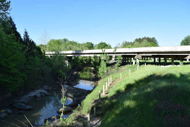
After returning to the intersection with the spur trail, the main trail continues down into the second valley and then immediately ascends up the next hill. The trail continues for a quarter mile along a ridge before making the final descent, this time to a smaller overlook above the old channel of the Yalobusha River. From here you can see the Old River Nature Trail across the river.
One of the trail's footbridges
The trail then turns up the valley for a short distance before making the final steep ascent up a hill. From there it is a relatively easy 0.7-mile hike back to the trailhead. Much of this last section of the trail follows a very old road and has only very mild elevation changes.


Comments
Post a Comment